
Four Bainbridge Island Parks in Four Weeks
As warmer days are lingering near, you may be itching to spend more time outdoors. If you’re in search of some fresh air, try visiting one of these four lovely parks around the island. And if that’s not enough, check out 12 parks in 12 weeks by the Bainbridge Island Parks Foundation.
Frey Road
How to get there: Find Battle Point Park. Next, exit the park at the north gate onto Frey Road, walk east down the hill 20 yards and find the trailhead across the street.
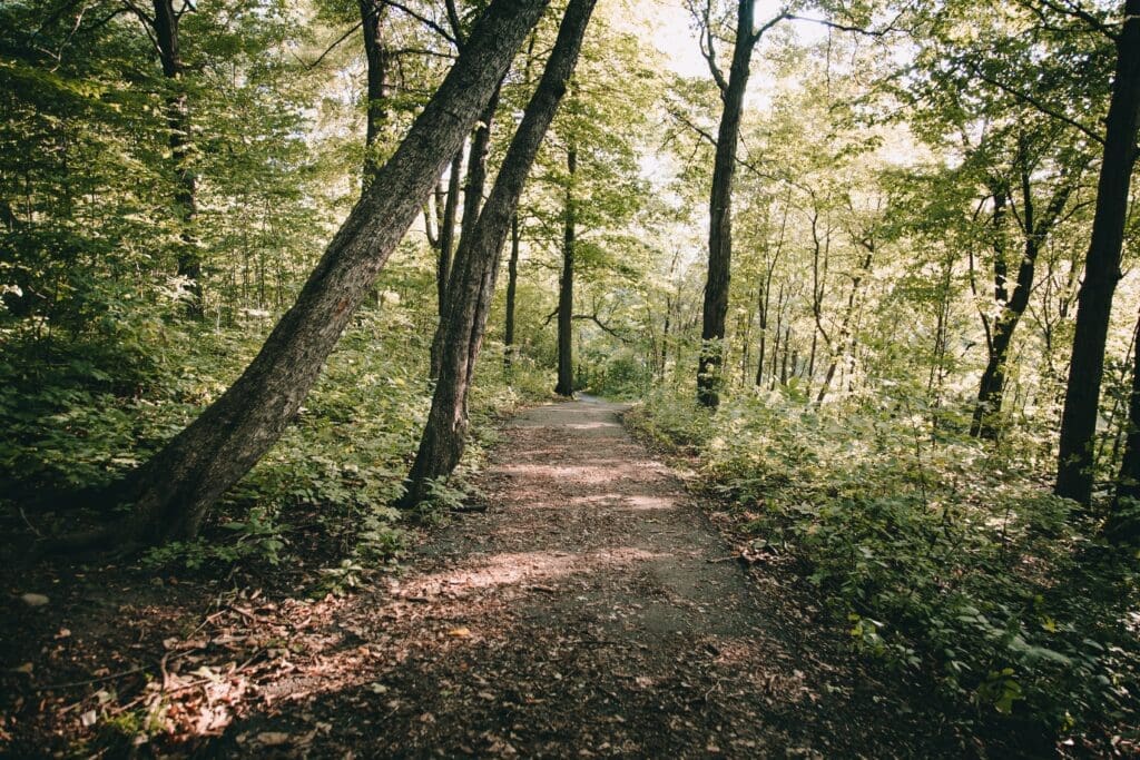
Why you should go: You’re at Battle Point Park for the millionth time anyway. Why not see something different? Fairy Dell Trail offers a pleasant hike through a wooded ravine and respite from the summer heat, with a little slice of island history in the mix. Leave the island’s busiest park for a few minutes, and try a path less traveled.
The easy, half-mile trail crisscrosses the long furrow of a seasonal stream via a series of stout, Eagle Scout footbridges. The ecosystem is a mixed affair, alternately sublime and blighted; you’ll be flanked by a glorious sea of ferns on one slope and a bleak ivy desert on the other. Ancient fir and cedar stumps are your waypoints.
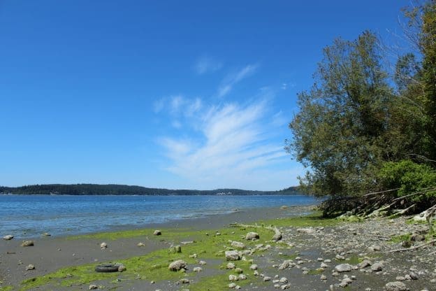
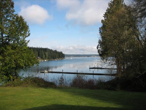
When you reach trail’s end, duck under the low-hanging overgrowth to find a tide flat sprawling endlessly before you at low water. Keyport lies ahead in the distance, the jagged rim of the Olympics to the left, and you can make out the Agate Pass Bridge to your right for a panoramic view indeed. Just don’t wear your good shoes.
Here’s another reason to go: to say you’ve been on one of the island’s oldest dedicated public trails, maybe the oldest. Fairy Dell was staked out around 1909, when today’s Battle Point was platted as a vacation community called Venice.
Upper reaches of the Grand Forest, east and west
How you get there: Hike. There is motor vehicle access off the end of lower Mandus Olson Road – look for the ad hoc “Prue’s House” sign around the bend from the parking area – but the driveway is generally gated for security. Your best bet is to park on either side of the Grand Forest, find a trailhead and start hoofing. Let the grade be your guide; uphill and you’re on the right path, and when it levels out into an open field, you’re there.
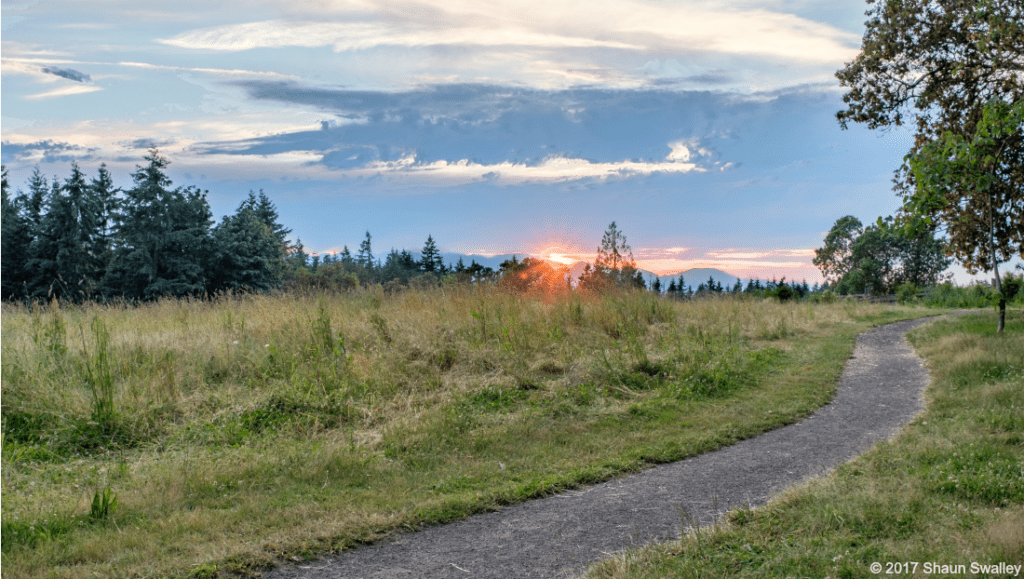
Why you should go: Hilltop is the Constantinople of Bainbridge parks, the junction where East meets West, the confluence into which miles of island trails flow. The 5-acre meadow at the crest is zenith for any number of possible day hikes; you could start at Battle Point Park at one end or McRedmond Road at the other, walk long enough and you’ll eventually find yourself at Hilltop summit.
Hilltop gets a lot of thru-traffic (runners and walkers) but perhaps fewer sustained visits than other parks. Poets and painters could find inspiration here. Look for natural highlights like the Royal empress trees, or a madrone and fir twinned in familial embrace; savor the quiet heirloom orchard, or imagine the rustic barn echoing the whinny of horses eager to graze the meadow.
Unlike most parks, you can’t really tell where Hilltop begins and ends, blurring as it does into some 540 contiguous acres of public land. But it’s more of an experience anyway, a state of mind. Try to time your visit to a sunny afternoon and feel the world shrink away beneath the azure sky. You might just believe you have the whole island to yourself…
Marshall Road
How you get there: Make your way to Gazzam Lake Preserve’s main entrance off Marshall Road. This is a great destination by bike, especially via pastoral, lightly traveled Island Center Road off Fletcher Bay. Once you reach the Preserve, hike west several hundred yards past the Springridge trailhead, crest the hill and keep going.
Why you should go: The Westwood Shore Trail is probably the most challenging hike Bainbridge has to offer. You plunge from the island’s second-highest point (Gazzam Lake, Elev. 380 ft.) to the shoreline (Elev. well, Zero) over seven precipitous tenths of a mile. The hike down requires a sure foot, the hike back up a stout heart. It’s not for the casual walker.
The path traverses the former Close property, acquired with Open Space bond funds in 2003 to add a 64-acre waterfront corridor to the previously landlocked Preserve. It’s a topographic wonder, all gouged ravines and dramatic slopes tumbling away at your feet into the green abyss. Actually, the trail is so steep at points that rude wooden steps are notched into the hillside for safety. The route is renowned for its acres of gentle ferns, although patches of ivy blight the lower reaches and are starting to climb the trees.
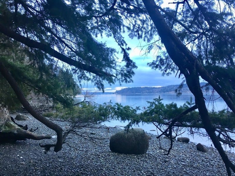
Your reward for reaching the bottom: 500 feet of lovely rocky shoreline along Port Orchard Narrows, one of the island’s more remote reaches in a nebulous stretch between upper Crystal Springs and the Hansen Road area to the north.
You get a peekaboo view at high tide, but a well-timed visit opens up the protected nearshore habitat to exploration. Bowed, second-growth firs cling to life against the slow encroachment of tide and time; signage reminds you this erosion – helpfully illustrated by a naturally sculpted mesa of sediment pocked with stones at the foot of the bluff – is an environmentally healthy process.
Williams Lane
How to get there: Take Koura Road west off Miller, then head straight down the hill as it turns into Williams Lane and buttonhooks into the park.
Why you should go: Another park rich in island lore, Williams-Olson is the last sliver of a larger, storied island homestead dating to pioneer times of Swedish settlers John Olson and Karin Persson Olson.
Here, kayakers will find the park an excellent jumping-off point for excursions of their own. Trundle your boat across the lawn and down to the broad 8-acre tide flat and off you go, skimming across the quiet bay.
The view from the bluff above is narrow but stunning beneath blue skies. Squint north and you can even make out the bridge at Agate Passage! Flanked by a pleasant orchard of apple and pear, the rolling lawn makes for great family picnicking, and you can get in a game of pickleball on the dedicated court.